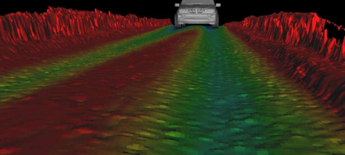
LiDAR and GNSS/INS sensor fusion for high-quality 3D mapping and inspection

Xenomatix is an established tier II automotive supplier providing LiDAR based solutions enabling autonomous driving, improved road safety and driving comfort. One of their innovative products is XenoTrack, designed for inspecting road quality with millimeter accuracy on global coordinates. XenoTrack fuses LiDAR data with reliable positioning and orientation (heading, pitch and roll) from Septentrio’s AsteRx SBi3 GNSS/INS receiver. By sending out 1000s of beams simultaneously XenoTrack creates a “rolling carpet” 3D map of the road surface. Every measurement (taken at 60Hz) is tagged, pin-pointing road damage with centimeter precision.
Road scanning systems need a functionality where the LiDAR stops mapping if the car is standing still. Especially in urban environments, high precision positioning and trustworthy error measurements are needed for this stop-and-go functionality to work well. Moreover, the Septentrio GNSS/INS allows long-distance road mapping without positioning drift. The ultimate test for Xenomatix is driving a long-distance circular route:
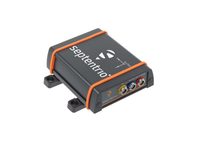
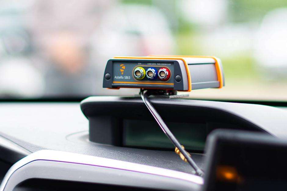
If we start driving and we stitch the road for tens of kilometers and we come back to the same starting point, then we see no offset. This is for us the strongest proof of accuracy and reliability of the GNSS/INS sensor from Septentrio.
Septentrio AsteRx SBi3 Pro+ GNSS/INS receiver is fused together with a LiDAR and CAN to enable a high-quality road profiling system: XenoTrack
- Millimeter-accurate road features are recorded by a unique LiDAR point cloud
- Over 9000 measured values per image
- 4m wide X 15m long area in every shot at 60Hz
- Stitching done primarily by image overlap, so a top-accuracy IMU is not required
- AsteRx SBi3 Pro+ in dual antenna mode provides global RTK cm-level positioning and orientation (heading, pitch and roll)
- When the car is moving faster and image overlay is smaller, orientation from INS assists SLAM for image stitching
- CAN input helps image stitching when the road is very smooth and stitching by image overlay is difficult
- As the car drives under bridges or in other areas where satellite visibility is obstructed, INS ensures continuous positioning by dead-reckoning
- GNSS geotagging is done in the post-processing step

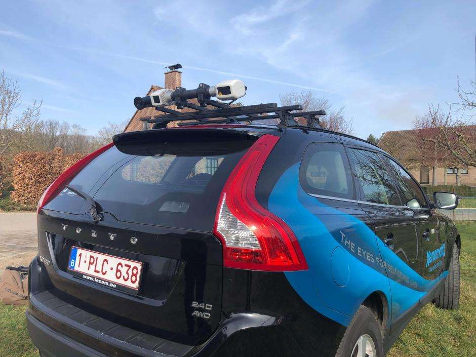
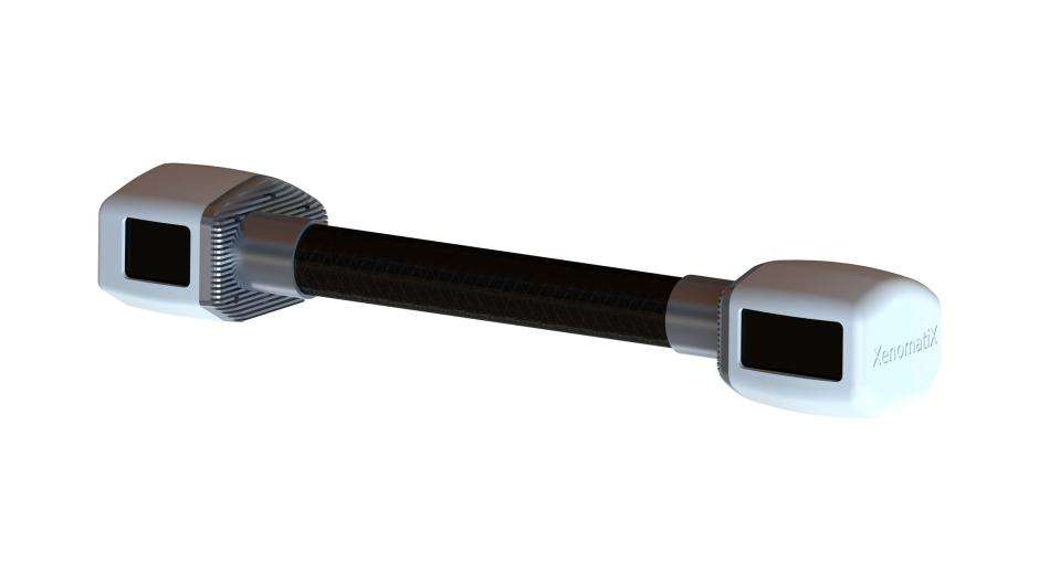
XenomatiX is the first company to offer true solid state lidar solutions for advanced driver assistance systems (ADAS) and autonomous driving (AD) and road digitization. XenomatiX designs and builds products and software that enable precise real-time 4D-6D digitization and an understanding of a vehicle’s surroundings, empowering applications that lead to safer and more comfortable vehicles. XenomatiX’ partnership with Tier 1 suppliers and automotive companies include, amongst others Marelli, AGC, Siemens, Imec, Septentrio, Cosworth, TOYO, JAT, Kautex and Shanghai ZK.
Related products

AsteRx SBi3 Pro

AsteRx SBi3 Pro+

AsteRx-i3 D Pro+
Related Insights
- What is spoofing and how to ensure GPS security?
- GNSS jamming and road tolling
- The role of GNSS localization in safe assisted driving
- The €50 chirp jammer that brought a multi-million Euro project to a standstill
Related Webinars
- Building New Realities With GNSS/INS
- GNSS Hacking, from Satellite Signals to Hardware/software cybersecurity
- The Era of Autonomy is Here: Going Beyond the Vehicle Phenomenon