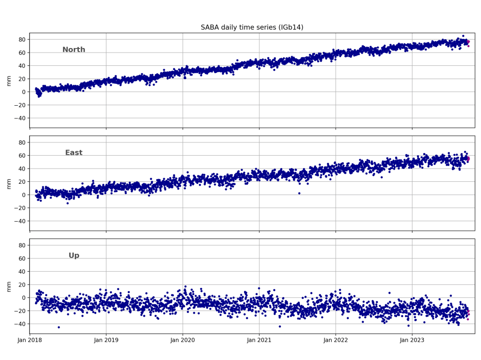
Monitoring volcanic activity with accurate reference stations

volcano-Image-by-Julius-Silver-

Saba and St. Eustatius (‘Statia’) are volcanic islands in the Caribbean Netherlands (Dutch Carribean). Due to subduction of the North and South American Plates under the Caribbean Plate, this region still has active volcanoes. The KNMI (Koninklijk Nederlands Meteorologisch Instituut) uses the PolaRx5S GNSS receivers to monitor the activity of volcanoes Mt. Scenery on Saba and The Quill on St. Eustatius.


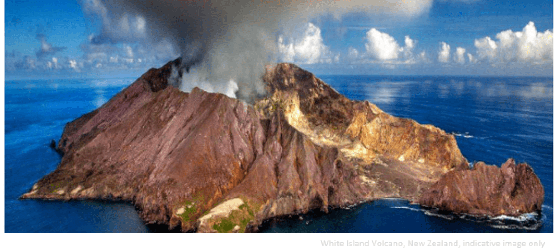
GNSS observations are well suited to help monitoring active volcanoes.

Elske de Zeeuw - van Dalfsen
Scientist at R&D Dept. Seismology and Acoustics, KNMI


Next to the already existing seismic network on the islands, the KNMI team installed 2 additional monitoring sites equipped with PolaRx5S reference receivers  and PolaNt Choke Ring B3/E6 antennas. Signals from multiple GNSS constellations are used to calculate the location of each antenna with high accuracy, sufficiently precise to detect minute motions caused by tiny deformations of the volcanic bedrock and surface. This data enables KNMI seismologists to make behavior models of volcanoes and allows them to predict tsunamis and issue earthquake warnings in the Dutch Caribbean.


KNMI-logo

The Royal Netherlands Meteorological Institute (in Dutch KNMI or Koninklijk Nederlands Meteorologisch Instituut) is the Dutch national weather service, which has its headquarters in De Bilt, in the province of Utrecht, The Netherlands. The primary tasks of KNMI are weather forecasting and monitoring of weather, climate, air quality and seismic activity. KNMI is also the national research and information centre for meteorology, climate, air quality and seismology.

Video credit KNMI